
十津川への長距離バスは五條から乗れるので、吉野から1時間かけて和歌山線の五條駅まで行った。駅から数分の国道沿いにバスセンターがあって、僕は急ぎ足でバスセンターに駆け込んだ。乗継時間は10分しかないし、最終便なので逃す訳にいかない。ところが実はこのバスの次の停留所が五條駅だった。何のことはない、駅で待っていれば良かったのだ。ここからの3時間は確かに長いのだが、途中は見事な渓谷の眺めもあり、車でのツーリングはきっと楽しいルートだと思う。終点の十津川温泉に着いたのは7時過ぎですでに日も暮れていた。確保しておいた民宿の松乃屋へはひとつ先のバス停蕨尾まで歩き、そこから川寄りの道に入る。他に今日の客はいないようだ。特に特長はない宿だが、登山口に近いのでここを選んだ。温泉は肌を滑るようなお湯で、ゆっくりくつろがせてもらった。
From Yoshino I took trains to Gojo where the express bus for long ride to Totsukawa Hot-spring can be caught. The bus center was a few minutes away along Route 24, and I moved quickly because I had only 10 minutes for transit and it was the last bus of the day to take. I actually found that the first stop after leaving was Gojo train station, therefore I only had to wait for the bus at the station. 3 hours from here was a long ride indeed, but you have beautiful views of the valley and the river on the way. A driving tour of this route must be wonderful. It was past 7 o’clock and already dark when I got to the destination. Matsunoya was the local inn I had booked and I walked up to the next bus stop. I picked it because it was close to the start point of Kumano Kodo. Nothing particular to mention about the inn, but it could be an occasion to experience the standard local style of staying. The hot spring water was mild and slippery on the skin, and I had a relaxed, easy bath after my long day of sakura tour in Yoshino.

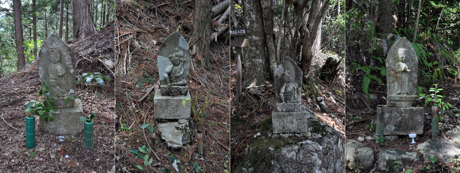
小辺路はちょっとしたトレッキングにはなかなか良いルートだと思う。両端のアップ・ダウンはそれなりにきついが、中間はフラットな道で距離を稼ぐところも多いし、時折渓谷や山々の景色も楽しめる。古くから人々が守ってきた伝統の道らしく整備も程良い。疲れて足が止まりそうになると石仏に鋭気をもらってまた歩き出せる。八木尾まで約5時間の行程だ。
翌朝8時宿を出発、柳本橋を過ぎて右の緩やかな上り坂を取る。向井去来の句碑があった。小辺路に入ったのは8時15分頃。やや急な昇りが続き、やがて30分ほどで畑に出る。

Kohechi seems to be a good trekking route with steep slopes in both ends but relatively flat trail in the middle and it offers wonderful views. The historic passage has been well maintained and the stone Buddha in 33 places greet to refresh you. It is about 5 hours from Totsukawa Hot-spring to Yagio. Kumano Shrine Hongu is 10km further away.
Leaving the inn at 8 in the morning, I took the ascending road on the right after crossing Yanagimoto Bridge. Soon is an unsurfaced narrow slope starting Kumano Kodo. I kept climbing for 30 minutes to get to a small farm.

ここは果無集落で、のどかな風景が美しく、世界遺産の大きな石碑も置かれているが、集落としての奥行きはなく、この眺めを見るだけなら車でも来ることはできる。
A tranquil view at Hatenashi Settlement. A large stone monument claimed World Heritage. It was not a profound village but a picturesque spot, and one can drive up here just to see how this view is like.

9時30分、天水田に着く。昔の田んぼ跡とのことだ。ここでしばらく休んでいると、大きな道標を担いだおじさんが登ってきた。話を聞くとそれを峠まで運んで立てるのだという。後から仲間も続くとのこと。いずれ追い抜かれるだろうと思いつつ、辞して先に進むことにする。
At 9:30 I arrived at Tensuiden, a deserted old rice field. While resting, a guy came up carrying a large signpost. He said a couple of others following him and they were to bring the posts up to the pass to put up. I excused and left the place assuming they would go ahead of me sooner or later.


10時45分、果無峠に着く。ここまで約2時間半。なるほどここの道標は粗末なもので、ちゃんと付け直したくなるのが分かる。ここで昼食でもしながらおじさんたちを待とうかと思ったが、食事にはやや早いのと、休むところもなく林の中より風が強かったので、あきらめて休憩20分して下りに入る。
Hatenashi Pass at 10:45, the peak point of 1,114m high. It took me 2.5 hours to get. The small, white signpost was indeed humble, and definitely nicer if replaced with the same one as in the entrance. I thought of waiting the guys to arrive having my lunch, but it was a little too soon to eat and also there was no place to comfortably hide from the wind, so I decided to leave after 20 minutes of pause.


疲れもあって余裕はなくなってきたが、七色分岐点には12時45分に着いた。12時半までならそのまま八木尾まで進み、13時を超すようなら要注意で七色に下山と考えていたので、ちょっと判断に悩んだが、急傾斜より緩やかな下りの八木尾に向かう2.3キロを選んだ。これは眺めもある気持の良いルートで正解だと思った。それでも最後はかなりの勾配が続いたが、階段状に整備された登山道を踏みしめながら先人たちの努力に感謝する。入口の標識に辿り着いたのが13時30分。これと同じ道標がもう峠にも立っただろうか?ホッとした途端、さらにバス停まで300メートルあるのが分かっても足がなかなか動かなかった。


The fatigue accumulated gradually on foot, and it was 12:45 when I reached Nanairo Junction. My plan was to go forward to Yakio if by 12:30 or descend directly to Nanairo if later than 13:00 as time might be tight for taking the bus. I could not immediately decide, but felt 2.3km of gradual slopes might be safer for my knees than a sharp downhill, and headed for Yakio. Still the final part continued with long steps going down quickly while I appreciated predecessors’ efforts to maintain the trail. I finally got to the signpost at 13:30, and I wondered if the same one already stood on the pass by that time? So much relieved, I could not easily move my feet further in realizing the bus stop was some 300m ahead of me.
No comments:
Post a Comment